
Mozambique: Aluminium production at Mozal increases by 12% in Q1
Zambezi basin: Mozambique, Zambia and Zimbabwe discuss collaborative management – Watch
12:57 CAT | 27 Jan 2017
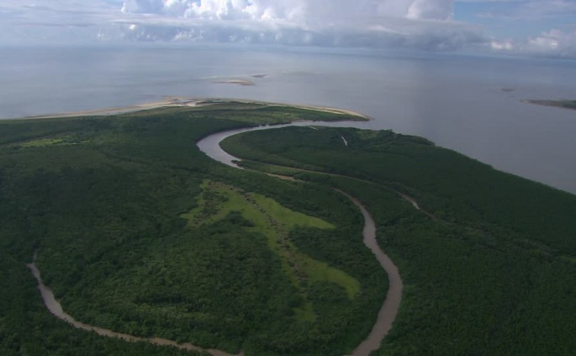
Marromeu National Park, Zambezi Delta, Mozambique
Mozambique, Zambia and Zimbabwe are assessing the impact of drought and the synchronization of operations of the Zambezi river dams at a three-day meeting which started on Wednesday in Songo, Tete province.
Zambezi river basin management authorities, dam operators and electric power producers are seeking to combine efforts towards a comprehensive, sustainable rationalization of water resources.
The Zambezi hydrographic basin covers an area of 1.4 million square kilometers with an estimated population of 32 million.
The Zambezi (also spelled Zambeze and Zambesi) is the fourth-longest river in Africa, the longest east-flowing river in Africa and the largest flowing into the Indian Ocean from Africa. The 2,574-kilometre-long river rises in Zambia and flows through eastern Angola, along the eastern border of Namibia and the northern border of Botswana, then along the border between Zambia and Zimbabwe to Mozambique, where it crosses the country to empty into the Indian Ocean.
The Zambezi’s most noted feature is Victoria Falls. Other notable falls include the Chavuma Falls at the border between Zambia and Angola, and Ngonye Falls, near Sioma in Western Zambia.
There are currently two main sources of hydroelectric power on the river, the Kariba Dam, which provides power to Zambia and Zimbabwe, and the Cahora Bassa Dam in Mozambique, which provides power to Mozambique and South Africa. There is also a smaller power station at Victoria Falls.

Source: TVM
Show comments
Also read


Leave a Reply
Be the First to Comment!
You must be logged in to post a comment.
You must be logged in to post a comment.