
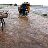
Floods forecast for 2026 affect Mozambique's economic projections, central bank warns
Mapping needed for effective exploration of maritime resources in Mozambique
11:21 CAT | 22 Jun 2017
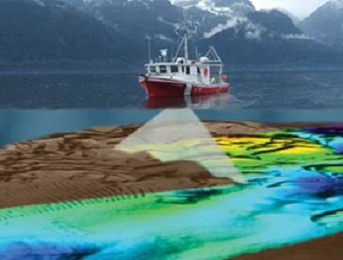
Canadian Hydrographic Service (File) / For illustration purposes only/ Illustrating seabed mapping using multibeam echosounder technology .
The exploration of Mozambique’s maritime potential requires comprehensive hydrographic survey work, Mozambique’s Minister of Transport and Communications Carlos Mesquita said during celebrations of World Hydrography Day yesterday, noting that the country’s location confers increased responsibilities in the promotion of regional and world maritime transport.
To this end, the minister inaugurated a vessel equipped with state-of-the-art technologies to study the access channels to national ports and so facilitate the entry and exit of vessels.
Minister Mesquita said that the National Institute of Hydrography and Navigation (INAHINA), an agency mandated with ensuring maritime signage and the production of nautical documents for the purpose of ensuring safety in navigation, had a major role to play.
He noted that the development corridors fed by Mozambique’s ports served as catalysts for the region’s economy, and it was therefore important to continue to raise the standard of hydrography in Mozambique.
“At the national level we are working to promote the immense potential of transport modes in the country and revitalise maritime cabotage so as to reduce the costs of transporting goods,” he said.
He pointed out that in order to reach this objective, particularly in the tertiary ports, Mozambique had to carry out thorough hydrographic surveys and update signage as well as producing reliable navigation documents.
Carlos Mesquita said that progress in guaranteeing the safety of navigation in the main ports of the country was evident, especially with the introduction of electronic charts in Maputo and work at the port of Beira.
Source: Notícias
Show comments
Also read


Leave a Reply
Be the First to Comment!
You must be logged in to post a comment.
You must be logged in to post a comment.