Mozambique: Arrested for alleged attempt to sell 27-year-old friend, 6-year-old daughter - Watch
Disease outbreaks: INGC maps potential risk areas in Sofala – Mozambique

Photo: Noticias
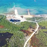
The National Institute for Disaster Management (INGC) in Mozambique is using drones to map areas affected by Tropical Cyclone Idai and flooding in the central province of Sofala.
This mapping will serve to support the health sector in the identification of sites susceptible to the occurrence of waterborne diseases such as malaria, cholera, diarrhoea, vomiting and others, and to help local governments classify them as high, medium or low risk.
It will also help reorient the early warning system in these districts and assist in assessing the socio-economic impact of the damage caused by the combination of these two recent weather events, engendering a better approach to rapid emergency management.
António Beleza, National Deputy Director of the National Emergency Operational Centre (CENOE), told newspaper Notícias that the maps will help health authorities make strategic decisions in their prevention measures to avoid the spread of those diseases, isolating specific areas and enhancing clean-up campaigns
“This is an innovation in the approach to disaster risk management in Mozambique,” said António Beleza.
The operation started on Friday and is scheduled to last eight days, covering the city of Beira and the districts of Búzi, Dondo and Nhamatanda in Sofala, plus Muanza.
Basic health infrastructures in Beira have already been mapped using drones, and the mapping of school facilities affected by Cyclone Idai was to start yesterday, with the aim of gaining a better understanding of the level of damage in order to better tackle the rebuilding of these sites.
Beleza’s team has also mobilised about 900,000 oral vaccine doses to combat a possible spread of water-borne diseases.


Leave a Reply
Be the First to Comment!
You must be logged in to post a comment.
You must be logged in to post a comment.