

Luxury tourism in Africa often fails to benefit locals, new research shows
Cheneso enters Mozambique Channel, INAM issues weather alert
11:33 CAT | 23 Jan 2023
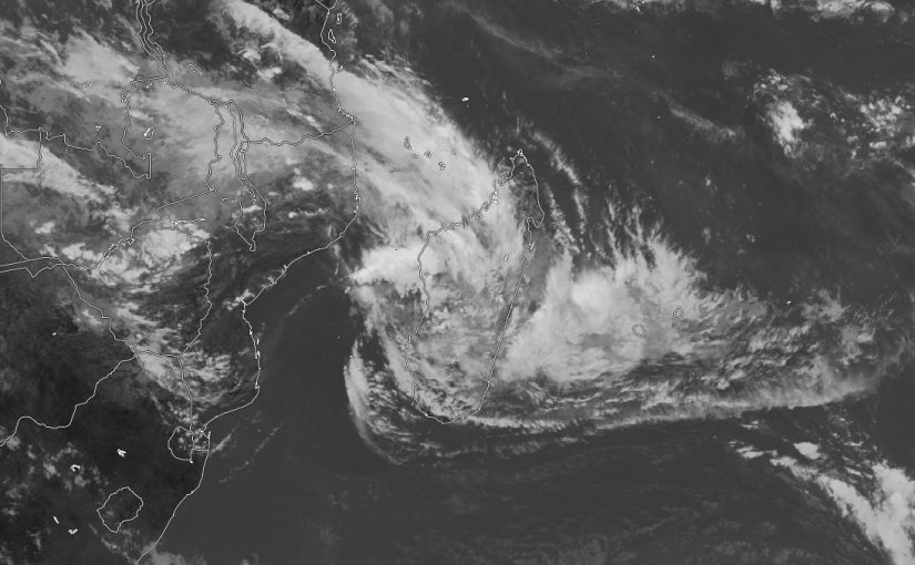
Image. Twitter / @jnmet
- At 12h00m local time today it was heading towards the Mozambican coast at 11 kilometres per hour, with the potential to evolve into a severe tropical storm.
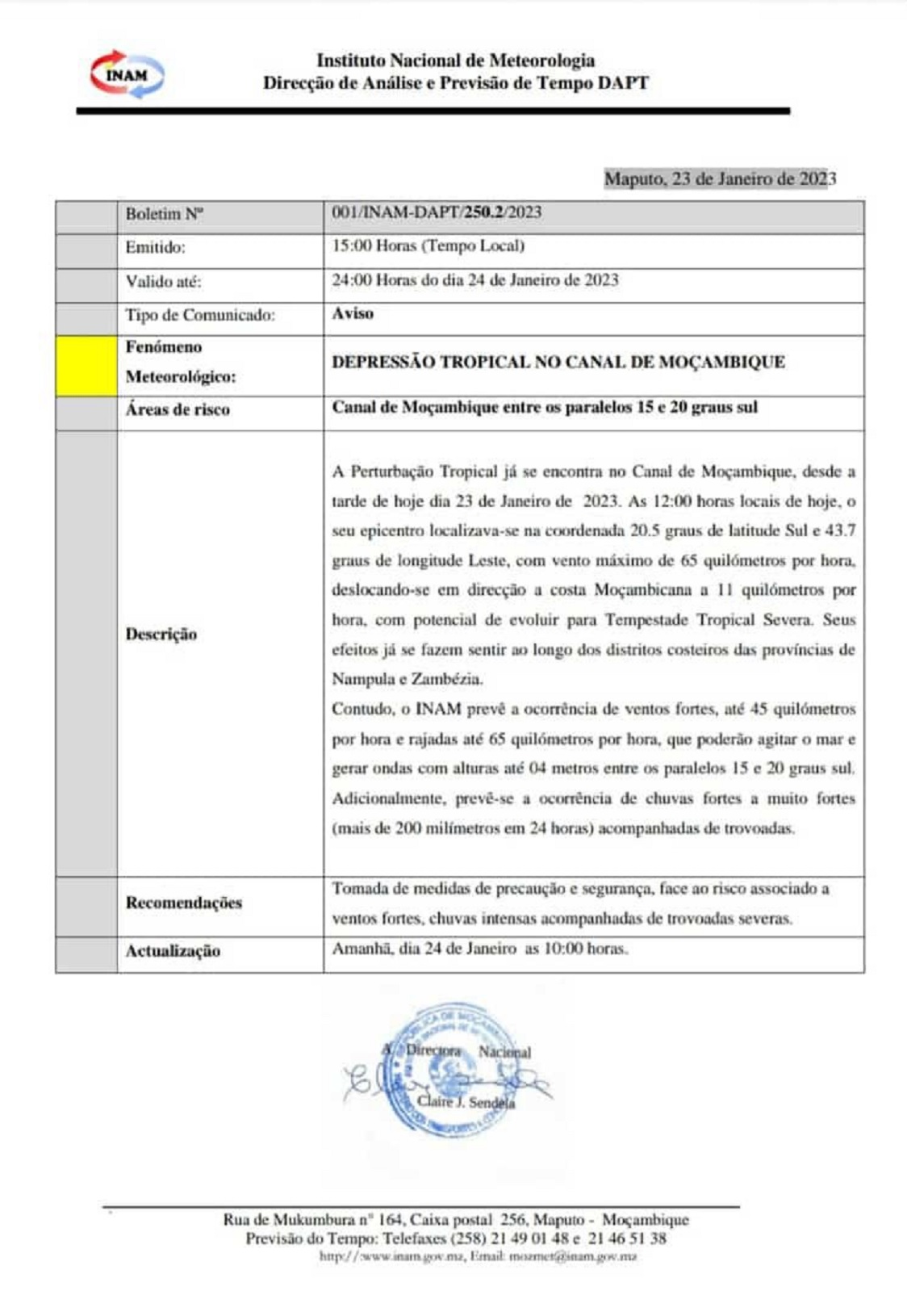
A tropical depression [Cheneso] entered the Mozambique channel this Monday afternoon, the National Institute of Meteorology(INAM) announced in a weather alert issued at 3 pm today.
At 12:00 local time today, its epicentre was located at the coordinate 20.5 degrees South latitude and 45.7 degrees East longitude, with a maximum wind of 65 kilometres per hour and it was heading towards the Mozambican coast at 11 kilometres per hour, with the potential to evolve into a severe tropical storm.
Cheneso’s effects are already being felt in the coastal districts of Nampula and Zambézia provinces, warns INAM.
INAM forecasts the occurrence of strong winds up to 45 km/h and gusts up to 65 km/h. which may agitate the sea and generate waves of up to 04 meters between the parallels 15 and 20 degrees South.
Additionally, INAM expects heavy to very heavy rain (more than 300 mm in 24 hours) accompanied by thunderstorms.
INAM calls for precautionary and safety measures to be taken in view of the risk associated with strong winds and heavy rain accompanied by severe thunderstorms.
Animated MSI and recent MW images indicate that the LLC of #Cheneso has re-emerged over water and is still relatively well organized. Conditions are favorable & gradual to steady intensification is expected, with slow movement being the main limiting short-term factor. #tropicswx pic.twitter.com/kCZPGK3o6Y
— Sausiuswx (@Sausius_wx) January 23, 2023
#Cheneso has pushed into the #Mozambique Channel & can regenerate by Wednesday. Storm will continue to bring heavy rain to parts of #Madagascar into Fri with outer bands bringing some rain to the N coast of Mozambique Wed/Thu. Cheneso will turn S then SE Thurs & this weekend. pic.twitter.com/14DhgDdm1h
— Jason Nicholls (@jnmet) January 23, 2023
Source: INAM
Show comments
Also read


Leave a Reply
Be the First to Comment!
You must be logged in to post a comment.
You must be logged in to post a comment.