

Mozambique: State reclaims idle land
Mozambique: Disaster agency maps Licungo basin to reduce flooding risk – Watch
7:59 CAT | 07 Jun 2018
Lusa (File photo)
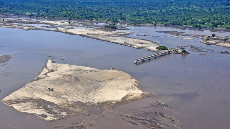
Mozambique’s National Institute for Disaster Management (INGC) will map the watershed of the country’s central Licungo River to reduce flood risks and improve emergency response planning, the agency said on Thursday.
The mapping is intended to “minimise risks” and promote timely preparation of actions when cyclones and floods are expected in the area of the river in Zambézia province, said Ana Cristina, director of Prevention and Mitigation services at INGC, quoted on Thursday by Mozambican daily newspaper Notícias.
The map will include areas of economic potential, evacuation plans, anticipation of the different flood levels that may occur, as well as the communities that may be affected and the number of people at risk.
The region of the Licungo basin is classified by INGC as a high-risk area in the rainy season that runs from November to April, and its most serious floods were seen there in 2015.
On 12 January of that year, water levels rose 12 metres and dragged away homes, bridges, power lines and agricultural fields, a disaster for the region that had not seen its like since 1971, according to the authorities.
Most of the 170 flood victims in Mozambique in 2015 were registered in Zambézia province.
Source: Lusa / TVM
Show comments
Also read


Leave a Reply
Be the First to Comment!
You must be logged in to post a comment.
You must be logged in to post a comment.